
ABot-Earth0.5 – Amap's World's First 3D-Native Urban World Model
Executive Summary:
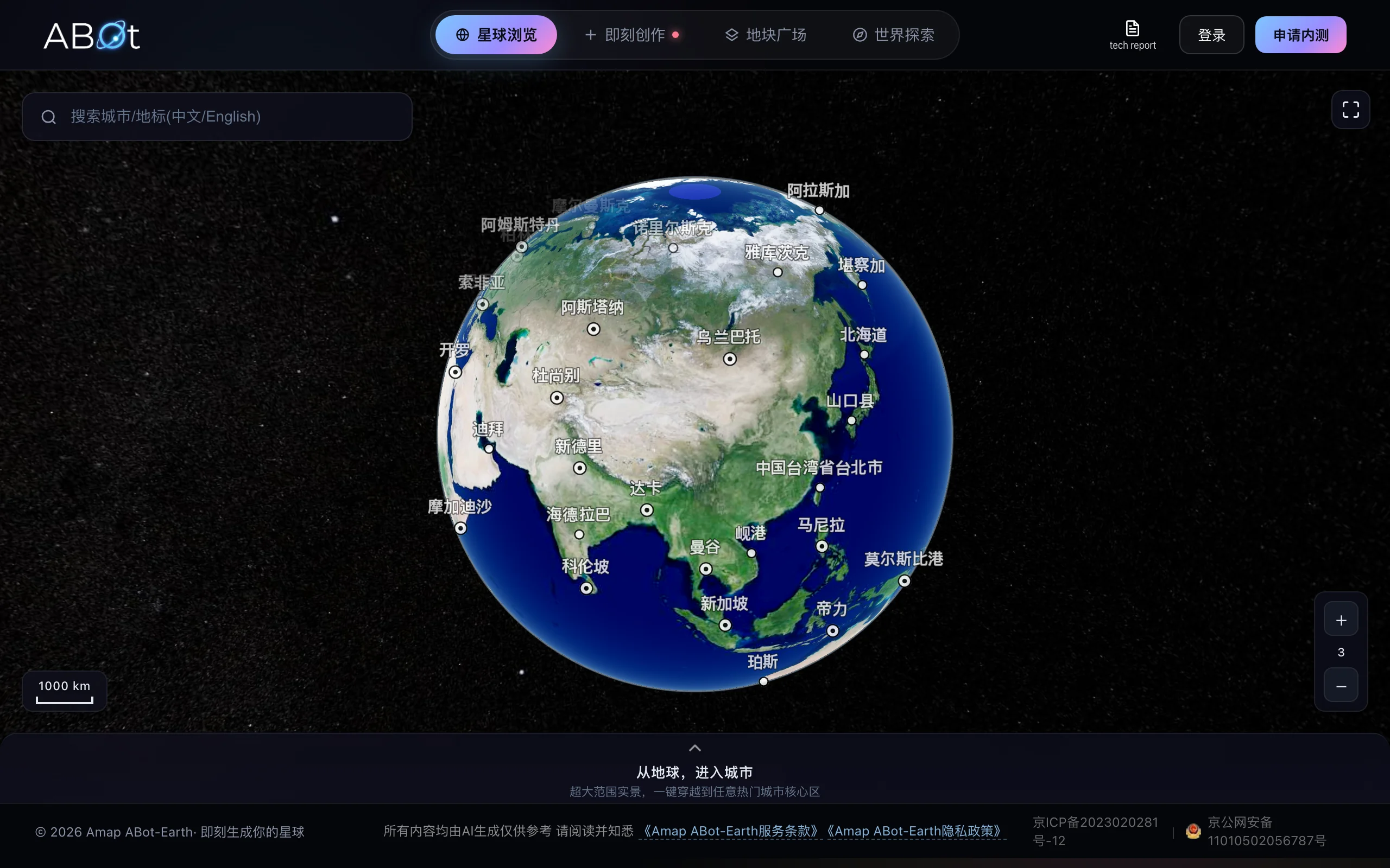
ABot-Earth0.5 is the world's first 3D-native urban world model from Amap, part of Alibaba Group. Positioned as an automated 3D city factory, users input a single satellite image or text description an...
1. What Is ABot-Earth0.5
ABot-Earth0.5 is the world's first 3D-native urban world model from Amap, part of Alibaba Group. Positioned as an automated 3D city factory, users input a single satellite image or text description and the system generates kilometer-scale, high-precision 3D city scenes on consumer GPUs in about 10 minutes. It outputs editable 3D Gaussian Splatting (3DGS) assets importable directly into Unity, Unreal Engine, and other mainstream engines. Through a generative AI end-to-end reconstruction pipeline, it compresses traditional manual modeling workflows of days or weeks into minutes, cuts cost to about 1% of conventional methods, improves efficiency by roughly 1000×, and marks a shift in city-scale 3D content production from heavy asset to lightweight tool.
Image source: Official article
Technical positioning and domain: ABot-Earth0.5 sits at the intersection of computer vision and computer graphics, focused on generative reconstruction and automated modeling of large-scale 3D scenes. Unlike multi-view photogrammetry or hand modeling, it uses 3D Gaussian Splatting (3DGS) as the core representation with generative AI for end-to-end mapping from a single 2D image or text to a complete 3D city asset. It is the first automated 3D factory that deeply fuses 3DGS with generative AI for city-scale scenes, surpassing traditional approaches in efficiency, cost, and editability.
Development background: Built by Amap's technical team with Alibaba's strength in cloud computing, AI, and map data. Amap's 3D map coverage across 190+ countries and regions provides massive high-quality geographic imagery and semantic labels for training. The motivation is traditional city 3D modeling's high cost (professional photogrammetry, manual cleanup, render farms) and slow cycles, which cannot meet demand for large-scale, low-cost, fast-iteration 3D city assets in gaming, autonomous driving, and the low-altitude economy.
Core value: ABot-Earth0.5 solves "high cost, low efficiency, high barrier" in city-scale 3D production. Core value spans three areas: cost disruption (about 1% of traditional 3D city mapping, affordable for small teams and individuals), efficiency revolution (kilometer-scale scenes in ~10 minutes on a consumer GPU, compressing weeks to minutes), and usability (no professional modeling skills; one satellite image or text prompt yields editable assets compatible with mainstream engines).
Technical characteristics: Core traits include 3DGS as scene representation with high rendering quality, editability, and real-time rendering; generative AI trained on large-scale city satellite imagery for end-to-end 2D-to-3D inference; fully automated pipelines from input to output; and model compression and inference optimization for consumer GPUs, moving compute from render farms to a single consumer GPU with roughly 1000× acceleration.
2. Key Features
Single-image/text 3D city generation: Input one satellite image or text (e.g., "Shinjuku, Tokyo"). The system parses geographic and architectural semantics, infers 3D structure, building height, surface texture, and semantic tags, and generates kilometer-scale high-precision 3D city scenes, simplifying workflows that traditionally depend on multi-view images or LiDAR point clouds.
Minute-scale efficient reconstruction: On consumer GPUs such as NVIDIA RTX 4090, city-scale generation and rendering take about 10 minutes. Compared with photogrammetry plus days to weeks of manual cleanup, efficiency improves by roughly 1000×, enabled by model compression, parallel optimization, and a lightweight inference engine.
3DGS format output: Native 3D Gaussian Splatting output uses millions of 3D Gaussian ellipsoids with color, opacity, and covariance to fit city geometry and appearance, preserving geometry, texture, and semantics. Versus mesh or NeRF, 3DGS supports real-time rendering, editing (move/delete individual Gaussians), and easy engine import.
Seamless engine integration: 3DGS assets import directly into Unity, Unreal Engine, and other platforms without conversion or post-processing. Developers can immediately add interaction, lighting, physics, and more for generate-and-use workflows.
Global coverage: A dataset covering 190+ countries and regions supports 3D city generation for terrains worldwide, from Manhattan to Shibuya via satellite image or place name.
Automated 3D factory pipeline: From user input to final 3D assets, the pipeline is fully automated with modules for image parsing, 3D structure inference, texture generation, semantic tagging, and 3DGS optimization in an end-to-end unattended production line.
3. How to Use
Apply for closed beta: Visit https://abot-earth.amap.com/ and click "Apply for Beta" top-right. Fill name, email, organization, and use case; review usually takes 1–3 business days with email notification on approval.
Log in and create a project: After approval, sign in to ABot-Earth Studio, click "New Scene," and choose "Image Generation" if you have satellite imagery or "Text Generation" for text-only input. First-time users should try image mode to validate results visually.
Input data and submit: For image mode, upload a clear satellite image (recommended ≥1024×1024, covering at least 1 km²). For text mode, enter a detailed city description, e.g., "Shinjuku, Tokyo: dense high-rise commercial buildings, ~15 m streets, park greenery." Click "Submit" to start generation.
Wait and download: Cloud generation takes about 10 minutes depending on complexity, with a progress bar in the console. When complete, click "Download Asset" for standard 3DGS (.ply or .splat). Import into Unity, Unreal, or a 3DGS viewer.
Key configuration: The model runs in the cloud only; no local setup is required. For local secondary development, use NVIDIA RTX 3090/4090+ with CUDA 11.8+ and Python 3.10+ and the official SDK. Local inference is not public yet; closed beta is cloud-only.
Notes and best practices: Avoid cloud cover in satellite images; prefer clear weather. More detailed text improves semantic accuracy. Kilometer-scale 3DGS files are large (~500 MB–2 GB); ensure stable download. For editing, use the official 3DGS Unity plugin or open tools such as gsplat.js.
4. Pros and Cons
| Pros |
|---|
| Cost disruption: 3D city mapping costs about 1% of traditional manual modeling, turning high-precision 3D generation from heavy asset to lightweight tool affordable for small teams. |
| 1000× efficiency: ~10 minutes on a consumer GPU for kilometer-scale scenes, roughly 1000× faster than traditional workflows, accelerating digital twins and game development. |
| Very low barrier: No render farm or workstation; consumer GPUs suffice; no 3D modeling skills required—satellite image or text is enough. |
| Global coverage: 190+ countries and regions—the broadest 3D city dataset coverage available—supporting fast generation for diverse terrains. |
5. Comparison with Similar Tools
| Dimension | ABot-Earth0.5 | Google Earth Studio | CityEngine (Esri) |
|---|---|---|---|
| Core architecture | Generative AI + 3DGS end-to-end reconstruction | 3D browse/animation on existing satellite data | Rule-based (CGA) procedural modeling |
| Generation method | Single satellite image/text → 3D city | No generation; browse existing 3D data | User rules → procedural buildings |
| Generation speed | 10 min / km-scale scene | Real-time browse (not generation) | Hours to days (complex rules) |
| Hardware | Consumer GPU (cloud) | Browser only | Professional workstation (GPU recommended) |
| Output format | 3DGS (editable, real-time) | No export / screenshots only | Proprietary .cej; FBX/OBJ export |
| Coverage | 190+ countries (global dataset) | Global (Google Maps data) | Manual build or imported geo data |
| Cost | ~1% of traditional (free in beta) | Free browse; paid advanced API | High licensing (enterprise $ tens of thousands/year) |
| Ease of use | Very low (upload and go) | Learn animation UI | Requires CGA scripting |
Selection advice: For fast, low-cost specific city 3D scenes in games or film, ABot-Earth0.5's 10-minute speed and 1% cost are decisive. For high-precision customizable urban modeling in smart cities or planning, CityEngine's rule-driven approach fits but needs more time and people. For large-scale synthetic data for autonomous driving or robotics, NVIDIA Omniverse Replicator offers fuller simulation and labeling but higher hardware barriers. Google Earth Studio suits video preview and demos without generation capability.
6. Editor's Take
ABot-Earth0.5 marks a new stage in city-scale 3D content production. Technically, it is the first deep fusion of 3D Gaussian Splatting with generative AI for end-to-end editable 3D city assets from a single 2D image—a pioneering route in the industry. Versus NeRF reconstruction, 3DGS wins on rendering speed, editability, and engine compatibility; versus procedural modeling like CityEngine, automation and efficiency improve by orders of magnitude. Running on consumer GPUs moves compute from render farms to ordinary GPUs, enabling broad adoption.
In practical terms, it serves game development, embodied AI, and the low-altitude economy's need for large-scale, low-cost, fast-iteration 3D city assets. Autonomous driving simulation needs many high-precision cities; traditional methods are costly, while ABot-Earth0.5 can generate digital twins worldwide quickly. Global coverage across 190+ countries means no custom data collection.
Audience: game developers, AD/robotics engineers, VFX artists, urban planners prototyping digital twins, and low-altitude economy practitioners needing 3D base maps. Still in closed beta, but core capability shows strong commercial potential.
Rationale: Top-tier innovation (5/5), strong practical value (5/5), excellent usability (5/5), but ecosystem maturity (3.5/5) and detail precision (4/5) still have room to grow. With broader beta and local deployment, it could become the de facto standard for city-scale 3D production.
7. Use Cases
Game development: Open-world games need large city base maps. Upload a satellite image and get editable 3D city assets in ~10 minutes for Unity or Unreal (interaction, NPCs, weather), cutting art cost by 90%+.
Embodied AI and AD simulation: Train algorithms across cities. ABot-Earth0.5 quickly generates high-precision global 3D scenes for synthetic data (camera, LiDAR, semantics) at low cost.
Low-altitude economy: Drone routing and airspace management need precise 3D base maps with building height, terrain, and obstacles for navigation and avoidance validation.
Emergency response: After disasters, generate 3D scenes from pre/post satellite or aerial imagery in ~10 minutes for deployment, evacuation routing, and supply simulation.
Film and digital twins: Quickly generate digital twin city backgrounds for virtual production instead of location shoots or hand modeling.
8. FAQ
Q: What hardware does ABot-Earth0.5 need?
A: Cloud-only today; no local hardware required. Future local releases likely need RTX 3090/4090+ (≥24 GB VRAM), Windows 10/11 or Ubuntu 20.04, CUDA 11.8+, Python 3.10+.
Q: How precise are generated cities? Suitable for AD simulation?
A: Scenes include geometry, texture, and semantic tags sufficient for perception validation (detection, segmentation). Millimeter-precision engineering (e.g., bridge inspection) needs high-precision LiDAR post-processing.
Q: Can 3DGS import into Blender or Maya?
A: Blender needs plugins (e.g., gsplat-blender); Maya has no native support. Unity and Unreal offer official 3DGS import tools; community tools include gsplat.js and gsplat-viewer.
Q: Who owns copyright? Commercial use?
A: Under beta terms, users own generated scenes for commercial use (games, film, simulation). Ensure legal rights to input satellite imagery (public or owned data).
Q: Does it support Chinese input?
A: Text mode supports Chinese city names and descriptions (e.g., "Beijing Guomao CBD, dense office towers"). Use clear, structured descriptions for best results.
Q: Compute for a 1 km × 1 km scene?
A: Cloud run uses ~10 minutes and ~8 GB VRAM (consumer GPU). Local version expected similar. 3DGS file size ~0.5–2 GB depending on density and texture detail.
9. Project Links
- Official site (beta application): https://abot-earth.amap.com/
Related AI Model Articles

In-Depth Review of Spark-ASR-2.0: A New Paradigm in Speech Recognition with Non-Autoregressive Architecture
Spark-ASR-2.0 is the latest generation speech recognition large model launched by iFLYTEK based on its proprietary Spark-Audio speech foundation model. This model continues the non-autoregressive para...
In-Depth Review of Step 5 Preview: A 600B Sparse MoE Flagship with 1M Token Context and 1/8 Cost Advantage
Step 5 Preview is a new-generation flagship foundation model launched by StepFun, designed for real-world Agentic tasks. Based on a sparse MoE architecture, the model has a total of 600B parameters bu...

Review: GLM-5.3-FlashX — Zhipu AI's High-Speed Inference Model, Setting a New Benchmark for Real-Time Interaction at 200 tokens/s
GLM-5.3-FlashX is a high-speed inference model launched by Zhipu AI in 2026, serving as an accelerated upgrade of GLM-5.3-Flash. Its core selling point lies in its maximum output speed of up to 200 to...
Open-RAIL Evaluation: China Mobile's Open-Source General-Purpose Engineering Foundation for Embodied Intelligence, Bridging the "Last Mile" for VLA/WAM Model Deployment
Open-RAIL is a general-purpose engineering foundation for embodied intelligence that China Mobile has open-sourced globally. It is positioned as the industry's first universal "nervous system" connect...
© All Rights Reserved. Some content on this site is partially generated by AI with human review.